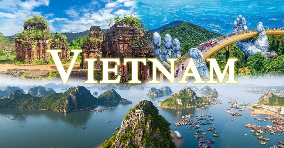
We look into the feng shui of Vietnam’s historic capitals.
From the dawn of our people’s history to the final dynasty, Vietnam’s political centers changed repeatedly, from Phong Chau (Phu Tho) of the Van Lang – King Hung period (2000 B.C.); Co Loa / Spiral Citadel (Hanoi) of the Au Lac – An Duong Vuong era (257 B.C. – 208 B.C.) and Ngo dynasty (939 – 967); Me Linh (Vinh Phuc) during the revolution of the Trung Sisters (40-43); Long Bien (Hanoi) of the Early Ly dynasty (541 – 602); Dai La (Hanoi) of the three autonomous dynasties: Great King Bo Cai (8th century), Khuc clan (905-930) and Duong Dinh Nghe (931-937); Hoa Lu (Ninh Binh) of the Dinh dynasty (968 – 980) and Early Le dynasty (980 – 1009); Thang Long (Hanoi) of the following dynasties: Ly (1009 – 1125), Tran (1226 -1400), Later Le (1428 – 1527), Mac (1527 – 1529) and Revival Le (1529 – 1788); Tay Do (Thanh Hoa) of the Ho dynasty (1400 – 1407); Quy Nhon (Binh Dinh) of Emperor Thai Duc, proclaimed by Nguyen Nhac (1787 – 1788); Phu Xuan – Hue (Thua Thien Hue) of the Tay Son dynasty (1789 – 1802) and the Nguyen dynasty (1802 – 1945).

Early morning at the Mausoleum of King Minh Mang
Most of these former feudal capitals were encircled by water, typically a grand river serving as the song truoc (main river) and a network of tributary or distributary streams, which, in the words of the late professor Tran Quoc Vuong, served as “song sau” (supporting rivers).
For instance: Co Loa Citadel connects to the Hoang Giang river system. The ancient capital of Hoa Lu connects to the Day river system. The Imperial Citadel of Thang Long connects to the Nhi river system. And the Hue Imperial Citadel connects to the Huong (Perfume) river system.
As well as providing good feng shui to ensure the capital’s longevity, these rivers provide a touch of nature and strengthen military defenses, while serving as arterial transport routes that connect the citadel to the outside world.
Ancient Vietnamese capitals were described as “cities between two rivers”, a distinction, since many other capitals were built on both sides of a river. Thang Long Imperial Citadel and Hue Imperial Citadel are perfect examples of “cities between two rivers”
King Ly Cong Uan (also known as Ly Thai To) wrote a Royal Edict to move the capital from Hoa Lu to Thang Long, due to its exceptional position. The new site was a flat, dry and bright highland in the center of the Northern Delta, backed by the chu son (key mountain) of Tan Vien Mountain, which would serve as a guardian pillar, while Nhi Ha River acted as chu luu (key river), confluent with the To Lich, Kim Nguu, and Thien Phu rivers, to form a “water shield” to protect the new capital.

The Mausoleum of King Gia Long featuers charming mountains and graceful river
Several large rivers border the northern and western flanks of this area, including the Cau, Lo and Da rivers, running down, as do the ends of several majestic mountain ranges from the north. To the east and southeast of Thang Long lies the dai thuy (grand wave) of the Eastern Sea, which gifts the area with great energy. This is known as the chan long (full-shaped dragon) position, the point where mountain and river energy meets and is concentrated, making it a promising land for a civilized nation. In Chieu doi do (Royal Edict on the Change of the Capital) King Ly Cong Uan wrote:
“Moreover, Dai La Citadel is in the very heart of the universe. The position evokes that of a soaring dragon and sitting tiger, in the centre of the four directions, is convenient for the development of the nation… After investigating all lands of Vietnam, this place is the gathering venue of people from across the nation, the most appropriate place for the location of the eternal capital.”
Beside the Perfume River
Unlike Hanoi, the Hue Imperial Citadel is located on a narrow strip of land, with the Eastern Sea on one side and the mighty Truong Son mountain range on the other, presenting the ideal feng shui elements for a long-lasting capital. Therefore, it was chosen by the Nguyen Lords as the capital of Dang Trong in both the Tay Son and Nguyen dynasties.

Long Bien Bridge spans the Red River
According to Dai Nam nhat thong chi (Dai Nam Comprehensive Encyclopedia) compiled by the History Academy of the Nguyen dynasty, after his coronation in 1802, King Gia Long declared Hue the capital. At that time, Hue was considered “the centre of the country”, rather than Thang Long, which was considered “the place of the eternal capital’s location”.
“Building the capital in the center of the country,” decreed the King, “is to balance the North-South distance, like a high roof with four views, like the Northern star shining over the whole constellation, our nation shall be permanently in peace and as strong as Thai Son Mountain. To everlasting glory and wealth!”
The Nguyen dynasty historians commented that Hue is “the home of mountains and sea, between the South and the North, high and dry land, offering a peaceful life, with deep and defensive estuaries such as Thuan An and Tu Hien, protected by Hoanh Son, Hai Van Gate, a grand river at the front and tall mountains at the back, forming the shapes of a sitting tiger and a soaring dragon. Such powerful land is blessed by God, worthy of a King’s Capital.”
The Nguyen dynasty’s capital had an ideal location, with Kim Phung Mountain as chu son (key mountain), Ngu Binh Mountain as tien an (protective front), the Huong River as song truoc (main river), and Bach Yen as song sau (supporting river). In addition, the Kim Long River runs through the area as the noi thuy (inner water), and the Huong River islets of Hen and Da Vien serve as ta thanh long (blue dragon on the left) and huu bach ho (white tiger on the right).
Upon completing the citadel’s construction, King Gia Long ordered that Ke Van and Dong Ba canals be dug on the western and eastern sides, placing the citadel in a “four-sided water shape”, in line with previous Vietnamese monarchs’ concept of “cities inside rivers”.

Vinh Tuy Bridge crosses Red River
To the west of Hue, small mountain ranges branch off from the Truong Son range’s great dragon’s vein. To the east, Bien Dong (Vietnam’s Eastern Sea) serves as the dai thuy (grand wave), strengthening the divine power, while a multitude of hills to the south function as natural ramparts that shield the capital. The Huong River meets the river systems of the Truoi and An Nong on the southern side, and those of the Bo and O Lau rivers on the norther side, forming ho sa (critical geographic locations) to reinforce the capital’s power.
By complementing natural topographic features like rivers, mountains, islets, and hills with wisely chosen man-made constructions, the Nguyen dynasty’s capital achieved a perfect balance of nature and architecture, rightfully earning its description as a “masterpiece of urban poetry”, a compliment Mr Amadou-Mahtar M’Bow, former Director-General of UNESCO, bestowed upon this charming land of rivers and mountains.


