Vietnam’s Four Points
An S-shaped country, Vietnam, stretches 1,650km from north to south, with the widest part about 500km across and the narrowest less than 50km wide. The country’s complex shape makes for an interesting story: where exactly are Vietnam’s southernmost, northernmost, easternmost, and westernmost points?
Travelers keen to explore the geographical and historical heritage of our ancestors, while discovering a deeper love for Vietnam’s nature, have long sought to visit the nation’s far corners, dubbed “the Four Points”.

Ca Mau Cape
“Bravely move from the high forest
Leading each other to Ca Mau”
The famous Love Song by composer Pham Duy summarized the journey of Vietnam’s expansion from the North to its southernmost point. Each of the Four Points stirs feelings about our homeland, defined by our cultural values. The sites’ natural beauty and national significance inspire people to visit. When visiting the Four Points, travelers’ backpacks don’t just hold numbers on GPS devices, but also deep emotions stirred by childhood stories and nursery rhymes.
Where the Nho Que River flows into Vietnam
The northernmost mountainous area in Vietnam is often called “the roof of Indochina”. Here, mountain ranges run from Hoang Lien Son toward Ha Giang, forming a conical hat on the northern border. The northernmost point lies in this area, below the Tropic of Cancer, where the Nho Que River enters Vietnam. It is marked by Milestone 428 in Seo Lung Village (Lung Cu commune, Dong Van district, Ha Giang province). Most tourists can only reach a spot about 4km away from the actual northernmost point – Lung Cu Flag Point at the summit of Rong Mountain, which stands 1,470m above sea level. The body of this octagonal-shaped flag tower is 33.15m-high. From the flagpole flies a 54-square-meter Vietnamese flag, representing the 54 ethnic groups in Vietnam.
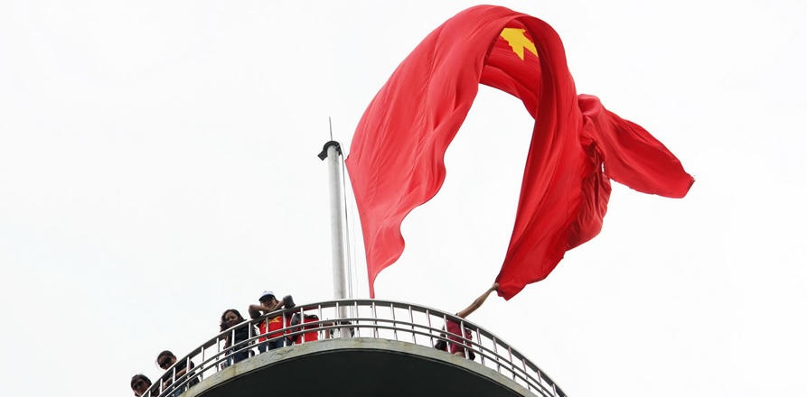
The Lung Cu Flag Point at the summit of Rong Mountiant (Ha Giang)
Lung Cu Flag Point has become a signature tourism destination in the North, thanks to its charming natural landscape and the distinctive culture of the Dong Van Karst Plateau Geopark. Visitors will find many other beauty spots nearby, such as the flower fields on the way to Heaven’s Gate and Fairy Mountain in Quan Ba, Dinh Vua Meo (Meo King’s Palace), and the magnificent Ma Pi Leng Pass encircling the Nho Que River. This landscape has earned Ha Giang a reputation as the most exciting tourist destination in Vietnam.
Through the distant mountains of Tay Bac
Vietnam’s westernmost point also lies in the mountains. A Pa Chai is marked by Milestone No. O at the T-junction of the Vietnam-Laos-China border. Tourists must conquer a 200km-long ride through the mountains from Dien Bien Phu to Muong Nhe, and continue 60km to reach the border post of A Pa Chai. From here to the T-junction is 11km through beautiful scenery. In the spring the road is captivating thanks to magical blossoms. In March, visitors will find wild sweet pea blooms, while autumn brings golden fields of ripening rice. Come winter, the landscape can turn icy. The journey to discover the westernmost point takes visitors past the historic battlefield of Dien Bien Phu and villages that are home to Thai, H’Mong, Dao, and other ethnic minority people, introducing travelers to this region’s cultural diversity.
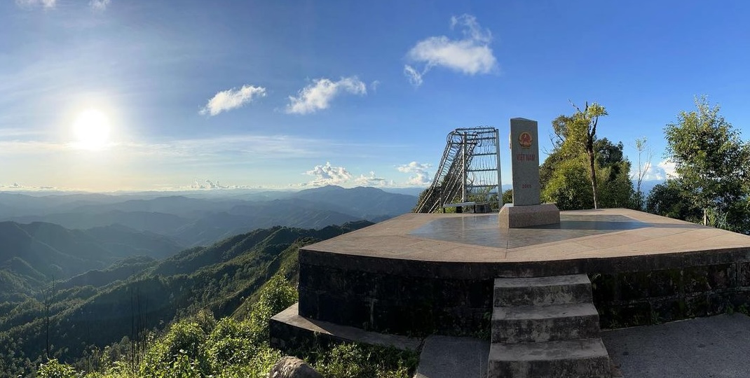
A Pa Chai Point (Dien Bien)
The halo of the sun
The easternmost point was once a demarcation between peninsulas that protrude into the East Sea in Central Vietnam. Mui Doi (Van Ninh, Khanh Hoa) is the first place in Vietnam to greet the sunrise, making it the official easternmost point. That title was once given to Mui Dien (Dong Hoa, Phu Yen), about 50km to the north. Located in the belly of our S-shaped country, this area is home to some of the most beautiful beaches in Vietnam and the world. Mui Doi is situated on Hon Gom Peninsula, with three sides facing the sea. Mui Dien boasts the famous Dai Lanh Lighthouse, near Ca Pass and Vung Ro Bay. Visitors can enjoy a magnificent winding coastal drive.
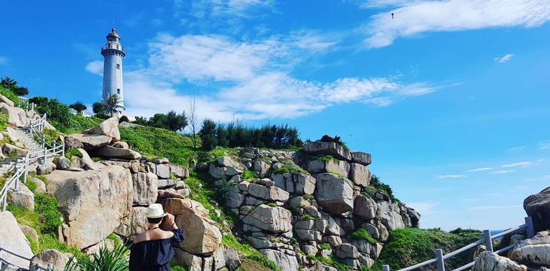
Mui Doi is situated on Hon Gom on Peninsula, with three side facing the sea.
Where the sun rises and sets
While the northernmost, easternmost, and westernmost points of Vietnam have only recently started to draw tourists, the southernmost point – Ca Mau Cape – is a longstanding symbol of Vietnam’s cultural formation. Ca Mau is considered a fixed and iconic point in Vietnamese culture. At the same time, Ca Mau Cape is always shifting, since rich silt from the Mekong Delta is continuously accumulating there and expanding the area for planting.
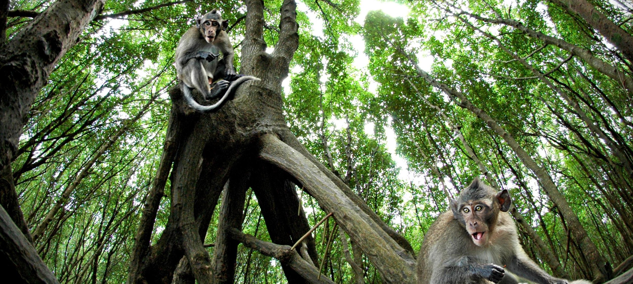
Mangroves on Ca Mau Cape
Thanks to this changeable topography, there are many different opinions about the actual southernmost point. No matter what, Ca Mau Cape is iconic and represents the country’s furthest reach. As the song Returning to Ca Mau Cape by Hoang Hiep states: “each alluvial grain accumulates and grows more forest…” This process has occurred over centuries, with generations of Vietnamese people planting trees to secure the soil from erosion, as in the expression, “plant Avicenna first, black mangrove later”. After many years, the silt deposits became fields and shrimp ponds.
Nowadays, Ca Mau is known for its seafood and industrial products, yet no other place in Vietnam has Ca Mau’s advantage of overlooking both the East and West Sea (the Bay of Thailand). This means that tourists can stand on Ca Mau Cape and enjoy the sunrise and sunset. The coexistence of nature and humans is evident in this southernmost land.
Vietnam’s Four Points testify to the country’s diverse landscapes, from forests to coasts, mountains, rivers, and rocky ravines to rich silt river deltas. They resemble a perfect four-paneled artwork that depicts this magnificent land. Each panel has contributed to the formation of our country.

